Larsemann Hills
Larsemann Hills (The name as it would appear in a gazetteer)
Larsemann Hills (The name as it would appear on a map)
If this information is incorrect, please e-mail mapping@aad.gov.au
Place ID: 8142
Name ID: 686
Feature type:
Hill
Origin
This name originates from Australia.
It is part of the
Australian Antarctic Gazetteer and the SCAR Composite Gazetteer of Antarctica.
Names that other countries have for this feature:
Narrative
A group of bare, rounded hills from 80 m to 180 m high, which extends along the Ingrid Christensen Coast of Princess Elizabeth Land for about 15 km. Discovered in February, 1935, by a Norwegian expedition under Captain Klarius Mikkelsen. Mapped from air photographs taken by the Lars Christensen Expedition (1936-37). First visited and position fixed by M.M. Fisher, ANARE surveyor in 1957.
Named For
Called Larsemann Fjellene (The Larsemann Mountains) by Norwegian cartographers.
Location
Latitude:
69° 23' 41.6" S
-69.39488°
Accurate to 25m
Longitude:
76° 10' 24.0" E
76.17334°
Accurate to 25m
Altitude:
148 m
Accurate to 10m
Images
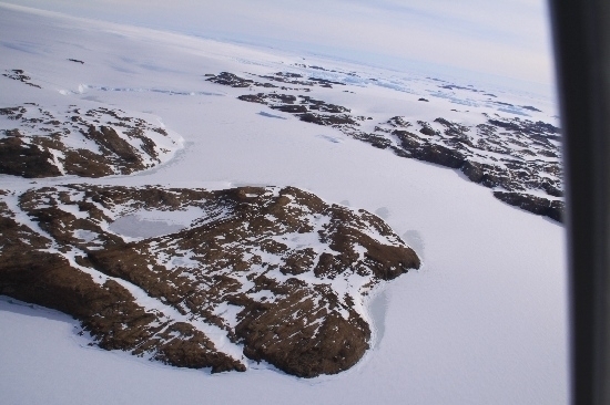
©Rick Oates 2009
- Catalogue id
- IA21798
- Caption
- Larsemann Hills. Taken from helicopter at height of 1900 feet. Looking East.
- Photographer
- Oates, Rick
Map
Source
Source Name:
Larsemann Hills 1:25000 Topographic GIS Dataset
Source Identifier:
Lars25K
Source Institution:
Australian Antarctic Division
Source Publisher:
Australian Antarctic Division
Remote sensing:
Not Applicable
Comments
None
Approval status
Related information