Map 12890: Vestfold Hills
Map details
| Map Number | 12890 |
| Title | Vestfold Hills |
| Edition | 3 |
| Previous edition | [Previous edition : 2] |
| Scale | 1 : 50 000 |
| Publication date | October 2001 |
| Publisher |
Australian Antarctic Division (Australia)
|
| Spatial coverage |
( 77.8333° -68.2500°)
,
( 78.6000° -68.2500°)
,
( 78.6000° -68.6833°)
( 77.8333° -68.6833°) |
| Projection | Universal Transverse Mercator |
| Physical size | 98 x 69 cm |
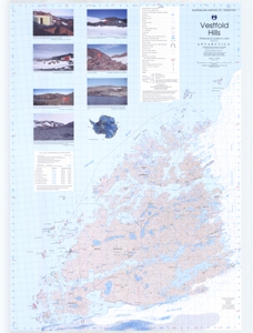
| Notes | Map is compiled from topographic information derived by photogrammetric methods from aerial photography flown in February 1997 and January 1994 with a Zeiss UMK13 aerial camera (format 120mm X 166mm). Insets include photos of refuges and geographic coordinates for the refuges in the Vestfold Hills. |
| Keywords | Vestfold Hills , Topographic , Prydz Bay , Davis , Station , Refuge , Fjord , Sorsdal Glacier , Marine Plain , Topographic |
Downloads
This is a hard copy map that has been scanned. See information about obtaining copies of hard copy maps.
- A print file (PDF)
- A zipped image (TIF) for use in Oziexplorer
- National Library of Australia Bib ID 3303314 (External site)
- A LZW compressed TIFF
Map Lists
This map belongs to the following lists. Use the link on the list to see all maps belonging to that list
Additional Information
| Horizontal datum | WGS84 |
| Vertical datum | Mean Sea Level |
| Magnetic variation | Magnetic north is 73.8 degrees west of true north |
| Nomenclature | Australian Antarctic Gazetteer |
Preview