Map 13264: Australian Antarctic Air Transport System, Map 2: Casey Runway location
Map details
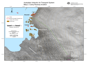
| Map Number | 13264 |
| Title | Australian Antarctic Air Transport System, Map 2: Casey Runway location |
| Edition | 3 (Out of Date) |
| Previous edition | [Previous edition : 2] |
| Next Edition | [Next Edition : 4] |
| Scale | 1 : 350 800 |
| Publication date | April 2006 |
| Publisher | - |
| Spatial coverage |
(109.8122° -66.1760°)
,
(111.9286° -66.1760°)
,
(111.9286° -66.7340°)
(109.8122° -66.7340°) |
| Projection | Universal Transverse Mercator |
| Physical size | 21 x 29.7 cm A4 |
| Notes | Prepared for the Air Transport Implementation Project. |
| Keywords | Air , Transport , Casey , Wilkins , Aeronautic |
Downloads
This is a digital map available for downloading.
Map Lists
No maps lists available.
Additional Information
| Horizontal datum | WGS84 |
| Vertical datum | Mean sea level |
Preview