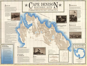
Map 156: Cape Denison Historic Site - Commonwealth Bay Antarctica
Map details
| Map Number | 156 |
| Title | Cape Denison Historic Site - Commonwealth Bay Antarctica |
| Edition | 1 |
| Scale | 1 : 3300 |
| Publication date | November 1990 |
| Publisher |
Australian Antarctic Division (Australia)
|
| Spatial coverage |
(142.6417° -67.0000°)
,
(142.7083° -67.0000°)
,
(142.7083° -67.0167°)
(142.6417° -67.0167°) |
| Projection | Not Given |
| Physical size | 62.5 x 83.5 cm |
| Reference | L9 |
| Keywords | Cape Denison , Round Lake , Long Lake , Alga Lake , Low Lake , High Lake , East Lake , Survey Marks , Historical |
Downloads
This is a hard copy map that has been scanned. See information about obtaining copies of hard copy maps.
- A print file (PDF)
- A LZW compressed TIFF
- National Library of Australia Bib ID 717929 (External site)
Map Lists
This map belongs to the following lists. Use the link on the list to see all maps belonging to that list
Additional Information
| Vertical datum | Mean Sea Level |
| Nomenclature | Australian Antarctic Gazetteer |
Preview