Name details
Solomon Island
Solomon Island (The name as it would appear in a gazetteer)
Solomon Island (The name as it would appear on a map)
If this information is incorrect, please e-mail mapping@aad.gov.au
Feature type: Island
Origin
This name originates from Australia. It is part of the Australian Antarctic Gazetteer and the SCAR Composite Gazetteer of Antarctica.
Narrative
The largest and easternmost of two islands about 1.25 km north-east of Donovan Promontory in the Larsemann Hills. Plotted from air photographs taken by the Lars Christensen Expedition, 1936-37.
Named For
Named after David Solomon, Officer Commanding Australian Army DUKW which landed the ANARE party on Jesson Island, Larsemann Hills, in February 1958.
Location
Images
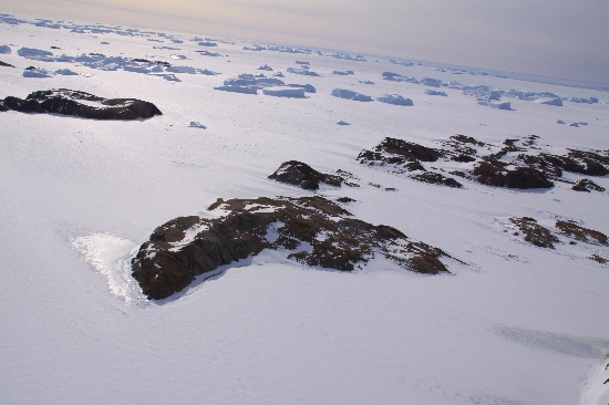
©Rick Oates 2009
- Catalogue id
- IA21819
- Caption
- Solomon Island, Larsemann Hills. Taken from helicopter at height of 1400 feet. Looking Southeast.
- Photographer
- Oates, Rick
Map
Source
Comments
NoneApproval status
Display Scales
For example, selecting 'Aus_display_scale_20M' would only return names that would appear on a 1:20 million scale map.
| Aus_display_scale_20M: | No | Aus_display_scale_10M: | No | ||
| Aus_display_scale_5M: | No | Aus_display_scale_2M: | No | ||
| Aus_display_scale_1M: | No | Aus_display_scale_500k: | No | ||
| Aus_display_scale_250k: | No | Aus_display_scale_100k: | No | ||
| Aus_display_scale_50k: | No | Aus_display_scale_25k: | No | ||
| Aus_display_scale_10k: | No | Aus_display_scale_5k: | No | ||
| Aus_display_scale_1k: | No |
Related information
Biodiversity
View
fauna,
flora or
both
within 1.0 degree of this location
Place names
View
Australian or
international
place names within 1.0 degree of this location.