Name details
Apfel Glacier
Apfel Glacier (The name as it would appear in a gazetteer)
Apfel Glacier (The name as it would appear on a map)
If this information is incorrect, please e-mail mapping@aad.gov.au
Feature type: Glacier (12)
Origin
This name originates from United States of America. It is part of the United States Gazetteer and the SCAR Composite Gazetteer of Antarctica.
Names that other countries have for this feature:
- Apfel Glacier (Australia)
- Apfel Glacier (Russia)
Narrative
Glacier about 5 mi wide and 20 mi long, flowing WNW along the S flank of Bunger Hills and terminating in Edisto Ice Tongue. Mapped from air photos taken by USN Operation HighJump, 1946-47, and named by the US-ACAN for Earl T. Apfel, professor of geology at Syracuse University, who served as geologist with the USN Operation Windmill parties, 1947-48, which established astronomical control stations along Queen Mary, Knox and Budd Coasts.
Named For
Location
Images
©AAD, Copyright Commonwealth of Australia 1999
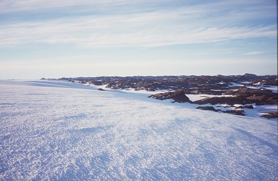
- Catalogue id
- 3766D1
- Caption
- Ice slope between Apfel Glacier and Bunger Hills
- Photographer
- Shevlin, James
Map
Source
Comments
NoneApproval status
Display Scales
For example, selecting 'Aus_display_scale_20M' would only return names that would appear on a 1:20 million scale map.
| Aus_display_scale_20M: | No | Aus_display_scale_10M: | No | ||
| Aus_display_scale_5M: | No | Aus_display_scale_2M: | No | ||
| Aus_display_scale_1M: | No | Aus_display_scale_500k: | No | ||
| Aus_display_scale_250k: | No | Aus_display_scale_100k: | No | ||
| Aus_display_scale_50k: | No | Aus_display_scale_25k: | No | ||
| Aus_display_scale_10k: | No | Aus_display_scale_5k: | No | ||
| Aus_display_scale_1k: | No |
Related information
Biodiversity
View
fauna,
flora or
both
within 1.0 degree of this location
Place names
View
American or
international
place names within 1.0 degree of this location.