Name details
Blair Peak
Blair Peak (The name as it would appear in a gazetteer)
Blair Peak (The name as it would appear on a map)
If this information is incorrect, please e-mail mapping@aad.gov.au
Feature type: Peak (2d)
Origin
This name originates from United States of America. It is part of the United States Gazetteer and the SCAR Composite Gazetteer of Antarctica.
Names that other countries have for this feature:
- Blair Peak (Australia)
- Blair Peak (Russia)
Narrative
Sharp peak, 960 m, situated 2 mi SE of Rumdoodle Peak in the Masson Range of the Framnes Mountains. Mapped by Norwegian cartographers from aerial photographs taken by the Lars Christensen Expedition, 1936-37. Remapped by ANARE, 1957-60, and named for James Blair, senior diesel mechanic at Mawson Station, 1958.
Named For
Location
Images
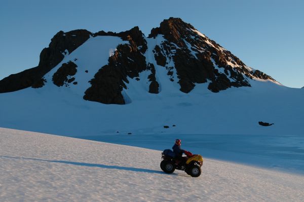
©Wade Fairley 2005
- Catalogue id
- IA16579
- Caption
- Blair Peak
- Photographer
- Fairley, Wade
Map
Source
Comments
NoneApproval status
Display Scales
For example, selecting 'Aus_display_scale_20M' would only return names that would appear on a 1:20 million scale map.
| Aus_display_scale_20M: | No | Aus_display_scale_10M: | No | ||
| Aus_display_scale_5M: | No | Aus_display_scale_2M: | No | ||
| Aus_display_scale_1M: | No | Aus_display_scale_500k: | No | ||
| Aus_display_scale_250k: | No | Aus_display_scale_100k: | No | ||
| Aus_display_scale_50k: | No | Aus_display_scale_25k: | No | ||
| Aus_display_scale_10k: | No | Aus_display_scale_5k: | No | ||
| Aus_display_scale_1k: | No |
Related information
Biodiversity
View
fauna,
flora or
both
within 1.0 degree of this location
Place names
View
American or
international
place names within 1.0 degree of this location.