Name details
Chappel Island
Chappel Island (The name as it would appear in a gazetteer)
Chappel Island (The name as it would appear on a map)
If this information is incorrect, please e-mail mapping@aad.gov.au
Feature type: Island (5)
Origin
This name originates from United States of America. It is part of the United States Gazetteer and the SCAR Composite Gazetteer of Antarctica.
Names that other countries have for this feature:
- Chappel Island (Australia)
- Chappel Island (Russia)
Narrative
The largest of the Donovan Islands, lying about 5 mi NW of Clark Peninsula in the E part of Vincennes Bay. The island has a number of large Adelie penguin rookeries. First mapped from air photos taken by USN Operation HighJump, 1946-47. Named by US-ACAN for CWO R.L. Chappel, USMC, motion picture officer on USN Operation HighJump photographic flights in this area and other coastal areas between 14 and 164 east longitude.
Named For
Location
Images
©AAD, Copyright Commonwealth of Australia 1973
- Catalogue id
- 1360B6
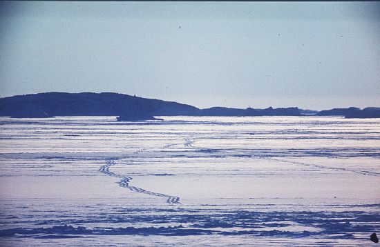
- Caption
- Foot tracks on sea ice. Chappel Island in the distance.
- Photographer
- McInnes, Gordon E
Map
Source
Comments
NoneApproval status
Display Scales
For example, selecting 'Aus_display_scale_20M' would only return names that would appear on a 1:20 million scale map.
| Aus_display_scale_20M: | No | Aus_display_scale_10M: | No | ||
| Aus_display_scale_5M: | No | Aus_display_scale_2M: | No | ||
| Aus_display_scale_1M: | No | Aus_display_scale_500k: | No | ||
| Aus_display_scale_250k: | No | Aus_display_scale_100k: | No | ||
| Aus_display_scale_50k: | No | Aus_display_scale_25k: | No | ||
| Aus_display_scale_10k: | No | Aus_display_scale_5k: | No | ||
| Aus_display_scale_1k: | No |
Related information
Biodiversity
View
fauna,
flora or
both
within 1.0 degree of this location
Place names
View
American or
international
place names within 1.0 degree of this location.