Name details
Sandefjord Ice Bay
Sandefjord Ice Bay (The name as it would appear in a gazetteer)
Sandefjord Ice Bay (The name as it would appear on a map)
If this information is incorrect, please e-mail mapping@aad.gov.au
Feature type: Bay (3)
Origin
This name originates from United States of America. It is part of the United States Gazetteer and the SCAR Composite Gazetteer of Antarctica.
Names that other countries have for this feature:
- Sandefjord Bay (Australia)
- Sandefjord, lednik buhta (Russia)
Narrative
A bay about 25 mi wide which forms the head of Prydz Bay. The feature is bounded on the west by Amery Ice Shelf, on the east by Publications Ice Shelf, and on the south by the mainland. Discovered in February 1935 by Capt. Klarius Mikkelsen in the Norwegian whaling ship Thorshavn sent out by Lars Christensen. They gave the name Sandefjordbukta after the town of Sandefjord, center of the Norwegian whaling industry. The term "ice bay" is applied to this feature because of its formation in ice, and to eliminate duplication of the name Sandefjord Bay.
Named For
Location
Images
©AAD, Copyright Commonwealth of Australia 1986
- Catalogue id
- 1791A3
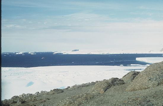
- Caption
- 1968 saw the four man wintering party Ice drilling party of Max Corry, Neville Collins, Alan Nichols, and Julian Sansom, winter on Amery Ice Shelf. These four have come to be known as the Troglodytes as they had to establish an underground tunnel system to connect various parts of the camp after heavy autumn snowfalls buried their caravans
- Photographer
- Corry, Maxwell (Max)
Map
Source
Comments
NoneApproval status
Display Scales
For example, selecting 'Aus_display_scale_20M' would only return names that would appear on a 1:20 million scale map.
| Aus_display_scale_20M: | No | Aus_display_scale_10M: | No | ||
| Aus_display_scale_5M: | No | Aus_display_scale_2M: | No | ||
| Aus_display_scale_1M: | No | Aus_display_scale_500k: | No | ||
| Aus_display_scale_250k: | No | Aus_display_scale_100k: | No | ||
| Aus_display_scale_50k: | No | Aus_display_scale_25k: | No | ||
| Aus_display_scale_10k: | No | Aus_display_scale_5k: | No | ||
| Aus_display_scale_1k: | No |
Related information
Biodiversity
View
fauna,
flora or
both
within 1.0 degree of this location
Place names
View
American or
international
place names within 1.0 degree of this location.