McLeod Island
McLeod Island (The name as it would appear in a gazetteer)
McLeod Island (The name as it would appear on a map)
If this information is incorrect, please e-mail mapping@aad.gov.au
Place ID: 9328
Name ID: 1002
Feature type:
Island
Origin
This name originates from Australia.
It is part of the
Australian Antarctic Gazetteer and the SCAR Composite Gazetteer of Antarctica.
Names that other countries have for this feature:
Narrative
A large island lying about 2 km north of Stornes Peninsula in the Larsemann Hills. Plotted from air photographs taken by the Lars Christensen Expedition 1936-37 and called Kollen (the knoll) by Norwegian cartographers.
Named For
Named after Ian McLeod, Geologist at Mawson in 1958 and a member of the ANARE party which landed in the Larsemann Hills in February 1958.
Location
Latitude:
69° 22' 02.0" S
-69.36722°
Accurate to 25m
Longitude:
76° 08' 25.0" E
76.14028°
Accurate to 25m
Altitude:
62 m
Accurate to 10m
Images
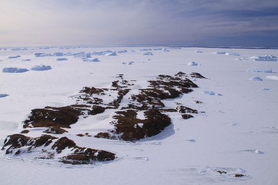
©Rick Oates 2009
- Catalogue id
- IA21805
- Caption
- McLeod Island, Larsemann Hills. Taken from helicopter at height of 1500 feet. Looking South.
- Photographer
- Oates, Rick
Map
Source
Source Name:
Larsemann Hills 1:25000 Topographic GIS Dataset
Source Identifier:
Lars25K
Source Institution:
Australian Antarctic Division
Source Publisher:
Australian Antarctic Division
Remote sensing:
Not Applicable
Comments
None
Approval status
Date approved:
29-Sep-1988
Related information