Dewart Island
Dewart Island (The name as it would appear in a gazetteer)
Dewart Island (The name as it would appear on a map)
If this information is incorrect, please e-mail mapping@aad.gov.au
Place ID: 3600
Name ID: 1031
Feature type:
Island
Origin
This name originates from Australia.
It is part of the
Australian Antarctic Gazetteer and the SCAR Composite Gazetteer of Antarctica.
Names that other countries have for this feature:
Narrative
One of the Frazier Islands. The region was photographed by USN Operation Highjump (1946-47). The position of the island was fixed by an ANARE party led by Phillip Law in January, 1956. Named by USACAN after G Dewart, a member of the 1957 Wilkes party.
Named For
Location
Latitude:
66° 13' 38.6" S
-66.22739°
Accurate to 30m
Longitude:
110° 09' 58.3" E
110.16619°
Accurate to 30m
Altitude:
52 m
Accurate to 5m
Images
©David Smith 2005
- Catalogue id
- IA16631
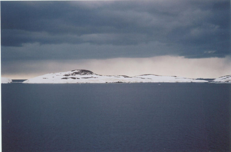
- Caption
- Dewart Island from the south-west
- Photographer
- Smith, David
Map
Source
Location Method:
Topographic data
Source Name:
Windmill Islands 1:50000 GIS Dataset
Source Identifier:
Wind50K
Source Institution:
Australian Antarctic Division
Source Publisher:
Australian Antarctic Division
Remote sensing:
Not Applicable
Comments
None
Approval status
Date approved:
4-Jul-1961
Related information