Eyres Bay
Eyres Bay (The name as it would appear in a gazetteer)
Eyres Bay (The name as it would appear on a map)
If this information is incorrect, please e-mail mapping@aad.gov.au
Place ID: 4422
Name ID: 108
Feature type:
Bay
Origin
This name originates from Australia.
It is part of the
Australian Antarctic Gazetteer and the SCAR Composite Gazetteer of Antarctica.
Names that other countries have for this feature:
Narrative
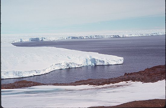
A bay formed by the Western side of Browning Peninsula and the Vanderford Glacier at the southern end of the Windmill Islands. The feature was first plotted from air photographs taken by USN Operation Highjump (1946-47). Named after Ensign D L Eyres, USN, a member of the Wilkes party in 1958.
Named For
Location
Latitude:
66° 29' 00.0" S
-66.48331°
Accurate to 30m
Longitude:
110° 28' 00.1" E
110.46669°
Accurate to 30m
Altitude:
0 m
Accurate to 5m
Images
©AAD, Copyright Commonwealth of Australia 1976
- Catalogue id
- 475C6
- Photographer
- Regester, Robin P
Map
Source
Location Method:
Topographic data
Source Name:
Windmill Islands 1:50000 GIS Dataset
Source Identifier:
Wind50K
Source Institution:
Australian Antarctic Division
Source Publisher:
Australian Antarctic Division
Remote sensing:
Not Applicable
Comments
None
Approval status
Date approved:
23-Oct-1962
Related information