Lake Burgess
Burgess, Lake (The name as it would appear in a gazetteer)
Lake Burgess (The name as it would appear on a map)
If this information is incorrect, please e-mail mapping@aad.gov.au
Place ID: 2070
Name ID: 1204
Feature type:
Water body
Origin
This name originates from Australia.
It is part of the
Australian Antarctic Gazetteer and the SCAR Composite Gazetteer of Antarctica.
Narrative
A branched lake in a wide open area of land about 1.3 km north-east from Blundell Peak in the Larsemann Hills.
Named For
Named after Jim Burgess, Limnologist, University of New South Wales who was a member of the 1987 summer field party at Law Base.
Location
Latitude:
69° 24' 53.9" S
-69.41498°
Accurate to 25m
Longitude:
76° 07' 45.1" E
76.12918°
Accurate to 25m
Altitude:
57 m
Accurate to 10m
Images
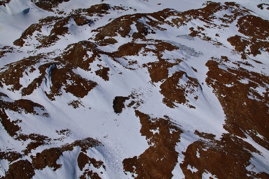
©Adam Christensen 2009
- Catalogue id
- IA21787
- Caption
- Lake Burgess, Larsemann Hills. Taken from helicopter at height of 1500 feet. Looking Southwest.
- Photographer
- Christensen, Adam
Map
Source
Source Name:
Larsemann Hills 1:25000 Topographic GIS Dataset
Source Identifier:
Lars25K
Source Institution:
Australian Antarctic Division
Source Publisher:
Australian Antarctic Division
Remote sensing:
Not Applicable
Comments
None
Approval status
Date approved:
29-Sep-1988
Related information