Aviation Islands
Aviation Islands (The name as it would appear in a gazetteer)
Aviation Islands (The name as it would appear on a map)
If this information is incorrect, please e-mail mapping@aad.gov.au
Place ID: 693
Name ID: 122054
Feature type:
Island
(5)
Origin
This name originates from United States of America.
It is part of the
United States Gazetteer and the SCAR Composite Gazetteer of Antarctica.
Names that other countries have for this feature:
Narrative
A group of small rocky islands lying 3 mi N of Cape Kinsey and the Wilson Hills. Mapped by the SovAE, 1958, and named Ostrova Polyarnoy Aviatsii (Polar Aviation Islands). The feature is the site of an Adelie penguin rookery.
Named For
Location
Latitude:
69° 16' 00.0" S
-69.26667°
Unknown precision
Longitude:
158° 47' 00.0" E
158.78333°
Unknown precision
Altitude:
Not recorded
Unknown precision
Images
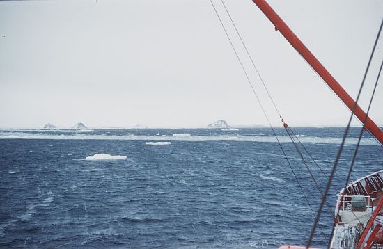
©AAD, Copyright Commonwealth of Australia 1961
- Catalogue id
- 3930C5
- Caption
- 3 miles north of the Wilson Hills in Oates Land
- Photographer
- Law, Phillip Garth (Phil)
Map
Source
Source Institution:
Unknown
Source Publisher:
Unknown
Remote sensing:
Not Applicable
Comments
None
Approval status
Date approved:
1-Jan-1964
Related information