Mount Bayliss
Bayliss, Mount (The name as it would appear in a gazetteer)
Mount Bayliss (The name as it would appear on a map)
If this information is incorrect, please e-mail mapping@aad.gov.au
Place ID: 1025
Name ID: 122294
Feature type:
Mountain
(2a)
Origin
This name originates from United States of America.
It is part of the
United States Gazetteer and the SCAR Composite Gazetteer of Antarctica.
Names that other countries have for this feature:
Narrative
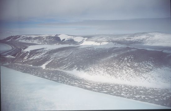
A relatively low mountain, extending 9 mi in an E-W direction, standing 6 mi E of Mount Menzies in the Prince Charles Mountains. Observed from ANARE aircraft in 1957 and seen in the same year by an ANARE ground party under K.B. Mather. Named by ANCA for E.P. Bayliss, Australian cartographer, who drew the map of Antarctica published in 1939 by the Property and Survey Branch, Dept. of Interior, Canberra.
Named For
Location
Latitude:
73° 32' 00.0" S
-73.53333°
Unknown precision
Longitude:
62° 44' 00.0" E
62.73333°
Unknown precision
Altitude:
Not recorded
Unknown precision
Images
©AAD, Copyright Commonwealth of Australia 1995
- Catalogue id
- 2783B5
- Photographer
- Godbold, Mathew (Matt)
Map
Source
Source Institution:
Unknown
Source Publisher:
Unknown
Remote sensing:
Not Applicable
Comments
None
Approval status
Date approved:
1-Jan-1961
Related information