Casey Bay
Casey Bay (The name as it would appear in a gazetteer)
Casey Bay (The name as it would appear on a map)
If this information is incorrect, please e-mail mapping@aad.gov.au
Place ID: 2376
Name ID: 123349
Feature type:
Bay
(3)
Origin
This name originates from United States of America.
It is part of the
United States Gazetteer and the SCAR Composite Gazetteer of Antarctica.
Names that other countries have for this feature:
Narrative
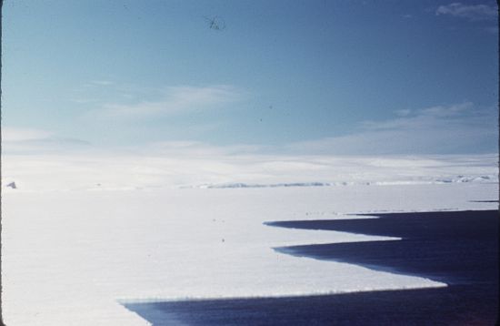
A large bay indenting the coast of Enderby Land between Tange Promontory and Dingle Dome. The feature was observed from ANARE aircraft in 1956. Named by ANCA for the Rt. Hon. Richard G. Casey (later Lord Casey), Australian Minister for External Affairs, 1951-60.
Named For
Location
Latitude:
67° 30' 00.0" S
-67.50000°
Unknown precision
Longitude:
48° 00' 00.0" E
48.00000°
Unknown precision
Altitude:
Not recorded
Unknown precision
Images
©AAD, Copyright Commonwealth of Australia 1961
- Catalogue id
- 2268A5
- Photographer
- Felton, Kevin
Map
Source
Source Institution:
Unknown
Source Publisher:
Unknown
Remote sensing:
Not Applicable
Comments
None
Approval status
Date approved:
1-Jan-1974
Related information