Central Masson Range
Central Masson Range (The name as it would appear in a gazetteer)
Central Masson Range (The name as it would appear on a map)
If this information is incorrect, please e-mail mapping@aad.gov.au
Place ID: 2459
Name ID: 123407
Feature type:
Range
(2c)
Origin
This name originates from United States of America.
It is part of the
United States Gazetteer and the SCAR Composite Gazetteer of Antarctica.
Names that other countries have for this feature:
Narrative
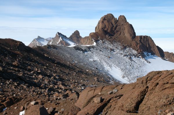
The Masson Range is divided into three parts of which this segment is the central, rising to 1,120 m and extending 4 mi in a N-S direction. The Masson Range was discovered and named by BANZARE, 1929-31, under Mawson. This central range was mapped by Norwegian cartographers from air photos taken by the Lars Christensen Expedition, 1936-37, and named Mekammen (the middle comb or crest). The approved name, suggested by ANCA in 1960, more clearly identifies the feature as a part of Masson Range.
Named For
Location
Latitude:
67° 50' 00.0" S
-67.83333°
Unknown precision
Longitude:
62° 52' 00.0" E
62.86667°
Unknown precision
Altitude:
1120 m
Unknown precision
Images
©Wade Fairley 2005
- Catalogue id
- IA16581
- Caption
- An easterly cliff face in Central Massom Range
- Photographer
- Fairley, Wade
Map
Source
Source Institution:
Unknown
Source Publisher:
Unknown
Remote sensing:
Not Applicable
Comments
None
Approval status
Date approved:
1-Jan-1965
Related information