Collerson Lake
Collerson Lake (The name as it would appear in a gazetteer)
Collerson Lake (The name as it would appear on a map)
If this information is incorrect, please e-mail mapping@aad.gov.au
Place ID: 2842
Name ID: 123699
Feature type:
Water body
(11)
Origin
This name originates from United States of America.
It is part of the
United States Gazetteer and the SCAR Composite Gazetteer of Antarctica.
Names that other countries have for this feature:
Narrative
A small, kidney-shaped lake 1.5 mi SW of Club Lake in the Vestfold Hills. A camp was established on the shores of this lake during geological investigations by K. Collerson, geologist at Davis Station in Jan. 1970, for whom it was named by ANCA.
Named For
Location
Latitude:
68° 35' 00.0" S
-68.58333°
Unknown precision
Longitude:
78° 11' 00.0" E
78.18333°
Unknown precision
Altitude:
Not recorded
Unknown precision
Images
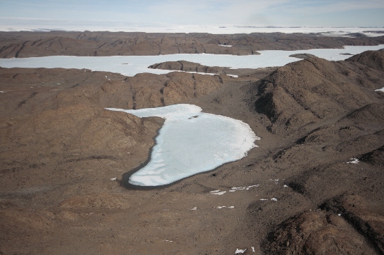
©Nathan Saunders 2009
- Catalogue id
- IA21914
- Caption
- Lake Collerson, Vestfold Hills. Taken from helicopter at height of 1000 feet. Looking South.
- Photographer
- Saunders, Nathan
Map
Source
Source Institution:
Unknown
Source Publisher:
Unknown
Remote sensing:
Not Applicable
Comments
None
Approval status
Date approved:
1-Jan-1973
Related information