Davis Anchorage
Davis Anchorage (The name as it would appear in a gazetteer)
Davis Anchorage (The name as it would appear on a map)
If this information is incorrect, please e-mail mapping@aad.gov.au
Place ID: 3377
Name ID: 124143
Feature type:
Anchorage
(3)
Origin
This name originates from United States of America.
It is part of the
United States Gazetteer and the SCAR Composite Gazetteer of Antarctica.
Names that other countries have for this feature:
Narrative
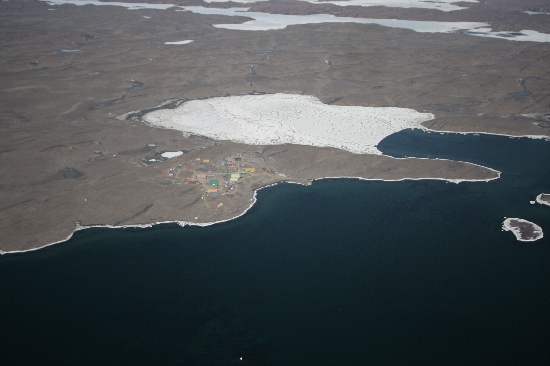
An anchorage about 1 mi in extent with general depths of 10 to 13 fathoms, lying off Breidnes Peninsula, Vestfold Hills. It is bounded on the west by Krat Rocks and Hobby Rocks, and on the east by the rocks and shoal water extending 0.5 mi offshore from Davis Station. The anchorage has been used by ANARE ships to Davis Station, for which it is named, since 1957.
Named For
Location
Latitude:
68° 34' 00.0" S
-68.56667°
Unknown precision
Longitude:
77° 55' 00.0" E
77.91667°
Unknown precision
Altitude:
Not recorded
Unknown precision
Images
©Nathan Saunders 2009
- Catalogue id
- IA21878
- Caption
- Davis Anchorage, Vestfold Hills. Taken from helicopter at height of 2500 feet. Looking South.
- Photographer
- Saunders, Nathan
Map
Source
Source Institution:
Unknown
Source Publisher:
Unknown
Remote sensing:
Not Applicable
Comments
None
Approval status
Date approved:
1-Jan-1965
Related information