Cape Denison
Denison, Cape (The name as it would appear in a gazetteer)
Cape Denison (The name as it would appear on a map)
If this information is incorrect, please e-mail mapping@aad.gov.au
Place ID: 3525
Name ID: 124265
Feature type:
Cape
(8)
Origin
This name originates from United States of America.
It is part of the
United States Gazetteer and the SCAR Composite Gazetteer of Antarctica.
Names that other countries have for this feature:
Narrative
A rocky point at the head of Commonwealth Bay. Discovered in 1912 by the AAE (1911-14) under Douglas Mawson, who named it for Sir Hugh Denison of Sydney, a patron of the expedition. The feature was the site of the AAE Main Base.
Named For
Location
Latitude:
67° 00' 00.0" S
-67.00000°
Unknown precision
Longitude:
142° 40' 00.0" E
142.66667°
Unknown precision
Altitude:
Not recorded
Unknown precision
Images
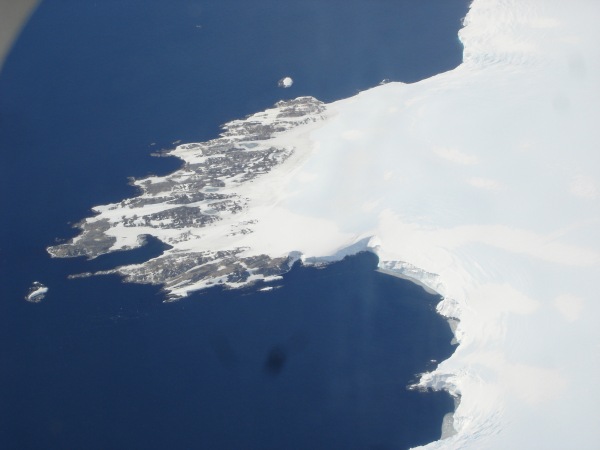
©Ursula Ryan 2005
- Catalogue id
- IA16564
- Caption
- Cape Denison from the air.
- Photographer
- Ryan, Ursula
Map
Source
Source Institution:
Unknown
Source Publisher:
Unknown
Remote sensing:
Not Applicable
Comments
None
Approval status
Related information