Penney Bay
Penney Bay (The name as it would appear in a gazetteer)
Penney Bay (The name as it would appear on a map)
If this information is incorrect, please e-mail mapping@aad.gov.au
Place ID: 11082
Name ID: 125
Feature type:
Bay
Origin
This name originates from Australia.
It is part of the
Australian Antarctic Gazetteer and the SCAR Composite Gazetteer of Antarctica.
Names that other countries have for this feature:
Narrative
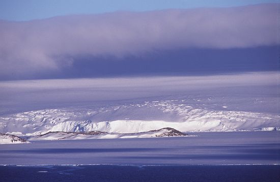
A large bay extending from Robinson Ridge to Browning Peninsula, Windmill Islands. The area was photographed by USN Operation Highjump (1946/47), ANARE (1956) and the Soviet Antarctic Expedition (1956). Named after R.L. Penney, biologist at Wilkes in 1959 and 1960.
Named For
Location
Latitude:
66° 26' 00.0" S
-66.43331°
Accurate to 30m
Longitude:
110° 36' 00.0" E
110.60000°
Accurate to 30m
Altitude:
0 m
Accurate to 5m
Images
©AAD, Copyright Commonwealth of Australia 1998
- Catalogue id
- 3435C6
- Photographer
- Dixon, Grant
Map
Source
Location Method:
Topographic data
Source Name:
Windmill Islands 1:50000 GIS Dataset
Source Identifier:
Wind50K
Source Institution:
Australian Antarctic Division
Source Publisher:
Australian Antarctic Division
Remote sensing:
Not Applicable
Comments
None
Approval status
Related information