Cemetery Lake
Cemetery Lake (The name as it would appear in a gazetteer)
Cemetery Lake (The name as it would appear on a map)
If this information is incorrect, please e-mail mapping@aad.gov.au
Place ID: 2451
Name ID: 1276
Feature type:
Water body
Origin
This name originates from Australia.
It is part of the
Australian Antarctic Gazetteer and the SCAR Composite Gazetteer of Antarctica.
Narrative
A lake about 650 m long and 400 m wide on the northern side of Mule Peninsula, Vestfold Hills. Visited by an ANARE geological and biological party in January-February 1972.
Named For
Mummified carcases of elephant seals, Weddell seals, giant petrels and a skua were found on its western beach buried in sand and gravel.
Location
Latitude:
68° 37' 32.9" S
-68.62581°
Accurate to 30m
Longitude:
77° 58' 09.8" E
77.96939°
Accurate to 30m
Altitude:
-2.1 m
Accurate to 5m
Images
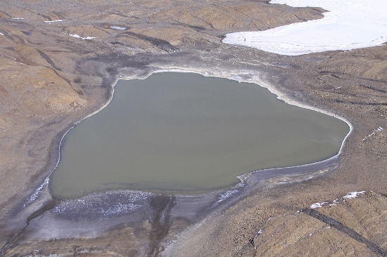
©Richard 'Tubby' Seton 2009
- Catalogue id
- IA21866
- Caption
- Cemetery Lake, Vestfold Hills. Taken from helicopter at height of 1400 feet. Looking Southwest.
- Photographer
- Seton, Richard
Map
Source
Location Method:
Topographic data
Source Name:
Vestfold Hills Topographic GIS Dataset
Source Identifier:
vest_hills_gis
Source Institution:
Australian Antarctic Division
Source Publisher:
Australian Antarctic Division
Remote sensing:
Not Applicable
Comments
Metadata for coordinates and origin of topographic data.
Approval status
Related information