Clear Lake
Clear Lake (The name as it would appear in a gazetteer)
Clear Lake (The name as it would appear on a map)
If this information is incorrect, please e-mail mapping@aad.gov.au
Place ID: 2745
Name ID: 1278
Feature type:
Water body
Origin
This name originates from Australia.
It is part of the
Australian Antarctic Gazetteer and the SCAR Composite Gazetteer of Antarctica.
Narrative
A lake about 1 km across in the western end of Mule Peninsula, Vestfold Hills. Photographed by the Lars Christensen Expedition (1936-37), USN Operation Highjump (1946-47), and ANARE 1956, 1957 and 1958. First visited by an ANARE party from Davis station during 1958.
Named For
So named because of the clarity of the water.
Location
Latitude:
68° 38' 22.0" S
-68.63944°
Accurate to 30m
Longitude:
77° 59' 25.0" E
77.99028°
Accurate to 30m
Altitude:
-8.4 m
Accurate to 5m
Images
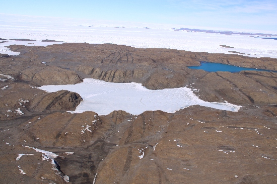
©Richard 'Tubby' Seton 2009
- Catalogue id
- IA21871
- Caption
- Clear Lake, Vestfold Hills. Taken from helicopter at height of 1000 feet. Looking South.
- Photographer
- Seton, Richard
Map
Source
Location Method:
Topographic data
Source Name:
Vestfold Hills Topographic GIS Dataset
Source Identifier:
vest_hills_gis
Source Institution:
Australian Antarctic Division
Source Publisher:
Australian Antarctic Division
Remote sensing:
Not Applicable
Comments
Metadata for coordinates and origin of topographic data.
Approval status
Date approved:
11-Aug-1958
Related information