George V Land
George V Land (The name as it would appear in a gazetteer)
George V Land (The name as it would appear on a map)
If this information is incorrect, please e-mail mapping@aad.gov.au
Place ID: 18307
Name ID: 1298
Feature type:
Land
Origin
This name originates from Australia.
It is part of the
Australian Antarctic Gazetteer and the SCAR Composite Gazetteer of Antarctica.
Narrative
That part of the Antarctic Continent between longitude 142 degrees E and longitude 155 degrees E. The coast of George V Land was explored and mapped by A A E. (1911-14) under Sir Douglas Mawson, as far as 153 degrees E. Named after H.M. King George V of England.
Named For
Location
Latitude:
68° 30' 00.0" S
-68.50000°
Unknown precision
Longitude:
148° 00' 00.0" E
148.00000°
Unknown precision
Altitude:
Not recorded
Unknown precision
Images
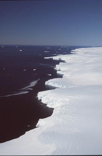
©AAD, Copyright Commonwealth of Australia 1986
- Catalogue id
- 1855D1
- Caption
- Coast of George V Land
- Photographer
- Reeves, Robert D (Bob)
Map
Source
Source Institution:
Unknown
Source Publisher:
Unknown
Remote sensing:
Not Applicable
Comments
None
Approval status
Related information