Pioneer Crossing
Pioneer Crossing (The name as it would appear in a gazetteer)
Pioneer Crossing (The name as it would appear on a map)
If this information is incorrect, please e-mail mapping@aad.gov.au
Place ID: 11301
Name ID: 130159
Feature type:
Crossing
(2e)
Origin
This name originates from United States of America.
It is part of the
United States Gazetteer and the SCAR Composite Gazetteer of Antarctica.
Names that other countries have for this feature:
Narrative
A low pass across Langnes Peninsula, Vestfold Hills, leading from the southeast arm of Tryne Fjord to Langnes Fjord. Mapped by Norwegian cartographers from air photos taken by the Lars Christensen Expedition (1936-37). The feature was visited by an ANARE sledging party led by B.H. Stinear (1957), and was named to record this first known traverse of the pass.
Named For
Location
Latitude:
68° 29' 00.0" S
-68.48333°
Unknown precision
Longitude:
78° 22' 00.0" E
78.36667°
Unknown precision
Altitude:
Not recorded
Unknown precision
Images
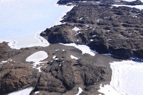
©Belinda Reynolds 2009
- Catalogue id
- IA21975
- Caption
- Pioneer Crossing, Vestfold Hills. Taken from helicopter at height of 1200 feet. Looking West.
- Photographer
- Reynolds, Belinda
Map
Source
Source Institution:
Unknown
Source Publisher:
Unknown
Remote sensing:
Not Applicable
Comments
None
Approval status
Date approved:
1-Jan-1961
Related information