Plog Island
Plog Island (The name as it would appear in a gazetteer)
Plog Island (The name as it would appear on a map)
If this information is incorrect, please e-mail mapping@aad.gov.au
Place ID: 11364
Name ID: 130203
Feature type:
Island
(5)
Origin
This name originates from United States of America.
It is part of the
United States Gazetteer and the SCAR Composite Gazetteer of Antarctica.
Names that other countries have for this feature:
Narrative
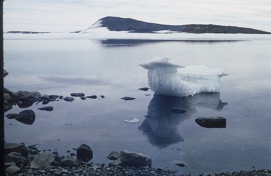
An island 1 mi long in Prydz Bay, lying 0.5 mi N of Lake Island and 0.5 mi W of Breidnes Peninsula, Vestfold Hills. Mapped by Norwegian cartographers from air photos taken by the Lars Christensen Expedition (1936-37) and named "Plogoy" (plow island), as being descriptive of the island's shape.
Named For
Location
Latitude:
68° 32' 00.0" S
-68.53333°
Unknown precision
Longitude:
78° 00' 00.0" E
78.00000°
Unknown precision
Altitude:
Not recorded
Unknown precision
Images
©AAD, Copyright Commonwealth of Australia 1972
- Catalogue id
- 2670B3
- Photographer
- Johnstone, Gavin W
Map
Source
Source Institution:
Unknown
Source Publisher:
Unknown
Remote sensing:
Not Applicable
Comments
None
Approval status
Date approved:
1-Jan-1965
Related information