Radok Lake
Radok Lake (The name as it would appear in a gazetteer)
Radok Lake (The name as it would appear on a map)
If this information is incorrect, please e-mail mapping@aad.gov.au
Place ID: 11822
Name ID: 130513
Feature type:
Water body
(11)
Origin
This name originates from United States of America.
It is part of the
United States Gazetteer and the SCAR Composite Gazetteer of Antarctica.
Names that other countries have for this feature:
Narrative
A meltwater lake about 4 mi long and marked by a slender glacier tongue feeding into it from the W, lying 3 mi SW of Beaver Lake and 15 mi SE of the Aramis Range, Prince Charles Mountains. Plotted by ANARE from air photos taken by the RAAF Antarctic Flight in 1956. Named for Uwe Radok, lecturer in meteorology at the University of Melbourne, who greatly assisted ANARE's glaciological program.
Named For
Location
Latitude:
70° 52' 00.0" S
-70.86667°
Unknown precision
Longitude:
68° 00' 00.0" E
68.00000°
Unknown precision
Altitude:
Not recorded
Unknown precision
Images
©Adrian Corvino 2004
- Catalogue id
- IA16516
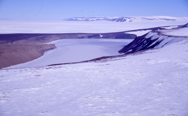
- Caption
- Photo taken from the plateau above northern end Radok Lake looking in a southerly direction towards Mount Meredith about 35 kilometres away. Pagodroma Gorge is behind the point protruding into Radok Lake on the left side of the photo.
- Photographer
- Corvino, Adrian
Map
Source
Source Institution:
Unknown
Source Publisher:
Unknown
Remote sensing:
Not Applicable
Comments
None
Approval status
Date approved:
1-Jan-1962
Related information