Newcomb Bay
Newcomb Bay (The name as it would appear in a gazetteer)
Newcomb Bay (The name as it would appear on a map)
If this information is incorrect, please e-mail mapping@aad.gov.au
Place ID: 10215
Name ID: 131
Feature type:
Bay
Origin
This name originates from Australia.
It is part of the
Australian Antarctic Gazetteer and the SCAR Composite Gazetteer of Antarctica.
Names that other countries have for this feature:
Narrative
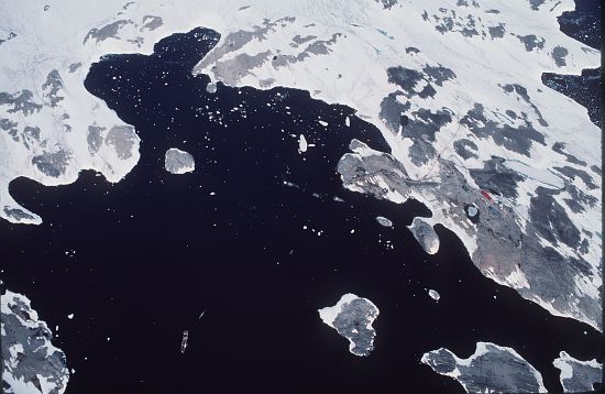
A bay on the Budd Coast, between Clark Peninsula and Bailey Peninsula. Plotted from air photographs taken by USN Operation Highjump (1946-47). Named by USACAN after Lieutenant R.C. Newcomb, USN, navigator of the USS Glacier and a member of a survey party which charted this bay in February, 1957.
Named For
Location
Latitude:
66° 16' 00.1" S
-66.26669°
Accurate to 30m
Longitude:
110° 32' 00.0" E
110.53331°
Accurate to 30m
Altitude:
0 m
Accurate to 5m
Images
©AAD, Copyright Commonwealth of Australia 1988
- Catalogue id
- 2792B2
- Photographer
- Zehnder, Bruno J
Map
Source
Location Method:
Topographic data
Source Name:
Windmill Islands 1:50000 GIS Dataset
Source Identifier:
Wind50K
Source Institution:
Australian Antarctic Division
Source Publisher:
Australian Antarctic Division
Remote sensing:
Not Applicable
Comments
None
Approval status
Related information