Tryne Crossing
Tryne Crossing (The name as it would appear in a gazetteer)
Tryne Crossing (The name as it would appear on a map)
If this information is incorrect, please e-mail mapping@aad.gov.au
Place ID: 15011
Name ID: 132922
Feature type:
Crossing
(2e)
Origin
This name originates from United States of America.
It is part of the
United States Gazetteer and the SCAR Composite Gazetteer of Antarctica.
Names that other countries have for this feature:
Narrative
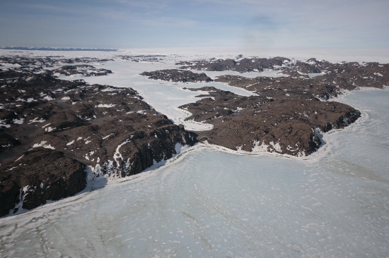
A low but rough pass across Langnes Peninsula, Vestfold Hills, leading from the southwest arm of Tryne Fjord to Langnes Fjord. Used for portage and sledges and probably suitable for tracked vehicles. The area was mapped from air photos taken by the Lars Christensen Expedition (1936-37), and was photographed by USN Operation Highjump (1946-47). First traversed by an ANARE party led by B.H. Stinear, May 13, 1957, and named for its association with Tryne Fjord.
Named For
Location
Latitude:
68° 30' 00.0" S
-68.50000°
Unknown precision
Longitude:
78° 18' 00.0" E
78.30000°
Unknown precision
Altitude:
Not recorded
Unknown precision
Images
©Nathan Saunders 2009
- Catalogue id
- IA22025
- Caption
- Tryne Crossing, Vestfold Hills. Taken from helicopter at height of 1200 feet. Looking East.
- Photographer
- Saunders, Nathan
Map
Source
Source Institution:
Unknown
Source Publisher:
Unknown
Remote sensing:
Not Applicable
Comments
None
Approval status
Date approved:
1-Jan-1961
Related information