Tryne Islands
Tryne Islands (The name as it would appear in a gazetteer)
Tryne Islands (The name as it would appear on a map)
If this information is incorrect, please e-mail mapping@aad.gov.au
Place ID: 15014
Name ID: 132924
Feature type:
Island
(5)
Origin
This name originates from United States of America.
It is part of the
United States Gazetteer and the SCAR Composite Gazetteer of Antarctica.
Names that other countries have for this feature:
Narrative
A group of numerous small islands and rocks, about 4 mi in extent, forming the western limit of Tryne Bay and Tryne Sound at the northeast end of the Vestfold Hills. Mapped by Norwegian cartographers from air photos taken by the Lars Christensen Expedition (1936-37) and named Trynoyane (the snout islands).
Named For
Location
Latitude:
68° 24' 00.0" S
-68.40000°
Unknown precision
Longitude:
78° 23' 00.0" E
78.38333°
Unknown precision
Altitude:
Not recorded
Unknown precision
Images
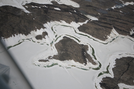
©Nathan Saunders 2009
- Catalogue id
- IA22028
- Caption
- Tryne Islands, Vestfold Hills. Taken from helicopter at height of 1500 feet. Looking South.
- Photographer
- Saunders, Nathan
Map
Source
Source Institution:
Unknown
Source Publisher:
Unknown
Remote sensing:
Not Applicable
Comments
None
Approval status
Date approved:
1-Jan-1965
Related information