Vincennes Bay
Vincennes Bay (The name as it would appear in a gazetteer)
Vincennes Bay (The name as it would appear on a map)
If this information is incorrect, please e-mail mapping@aad.gov.au
Place ID: 15521
Name ID: 133273
Feature type:
Bay
(3)
Origin
This name originates from United States of America.
It is part of the
United States Gazetteer and the SCAR Composite Gazetteer of Antarctica.
Names that other countries have for this feature:
Narrative
Large V-shaped bay, 65 mi wide at its entrance between Cape Nutt and Cape Folger and marked by several large, steep glaciers near its head, lying along Knox and Budd Coasts. Photographed from the air by USN Operation HighJump, 1946-47. The bay was entered in January 1948 by USN Operation Windmill icebreakers Burton Island and stations in the Windmill Islands in the NE portion of the bay. Named by the US-ACAN for the sloop of war Vincennes, flagship of the USEE under Wilkes, from which a series of coastal landfalls along Wilkes Land were discovered and plotted during January-February 1840. Wilkes' chart suggests a possible coastal recession corresponding closely with the longitudinal limits for Vincennes Bay, although pack ice conditions prevented close reconnaissance by the USEE of the coast in this immediate area.
Named For
Location
Latitude:
66° 30' 00.0" S
-66.50000°
Unknown precision
Longitude:
109° 30' 00.0" E
109.50000°
Unknown precision
Altitude:
Not recorded
Unknown precision
Images
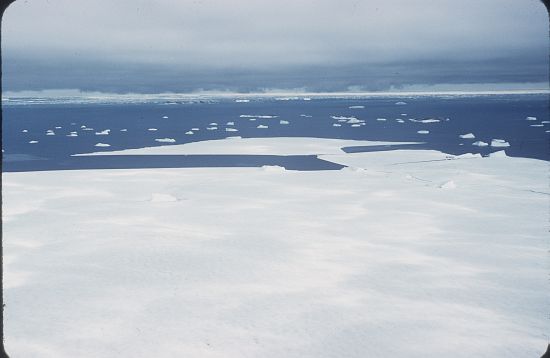
©AAD, Copyright Commonwealth of Australia 1959
- Catalogue id
- 4409C4
- Caption
- Fast ice breaking out
- Photographer
- Law, Phillip Garth (Phil)
Map
Source
Source Institution:
Unknown
Source Publisher:
Unknown
Remote sensing:
Not Applicable
Comments
None
Approval status
Date approved:
1-Jan-1956
Related information