Warriner Island
Warriner Island (The name as it would appear in a gazetteer)
Warriner Island (The name as it would appear on a map)
If this information is incorrect, please e-mail mapping@aad.gov.au
Place ID: 15751
Name ID: 133447
Feature type:
Island
(5)
Origin
This name originates from United States of America.
It is part of the
United States Gazetteer and the SCAR Composite Gazetteer of Antarctica.
Names that other countries have for this feature:
Narrative
A small island lying just off the W end of Breidnes Peninsula, Vestfold Hills. First mapped by Norwegian cartographers from air photos taken by the Lars Christensen Expedition, 1936-37. Named by ANCA for A. Warriner, radio officer at Davis Station, 1961.
Named For
Location
Latitude:
68° 37' 00.0" S
-68.61667°
Unknown precision
Longitude:
77° 54' 00.0" E
77.90000°
Unknown precision
Altitude:
Not recorded
Unknown precision
Images
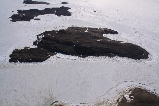
©Belinda Reynolds 2009
- Catalogue id
- IA22036
- Caption
- Warriner Island, Vestfold Hills. Taken from helicopter at height of 2500 feet. Looking West.
- Photographer
- Reynolds, Belinda
Map
Source
Source Institution:
Unknown
Source Publisher:
Unknown
Remote sensing:
Not Applicable
Comments
None
Approval status
Date approved:
1-Jan-1970
Related information