Mount Tritoppen
Tritoppen, Mount (The name as it would appear in a gazetteer)
Mount Tritoppen (The name as it would appear on a map)
If this information is incorrect, please e-mail mapping@aad.gov.au
Place ID: 14973
Name ID: 1458
Feature type:
Mountain
Origin
This name originates from Australia.
It is part of the
Australian Antarctic Gazetteer and the SCAR Composite Gazetteer of Antarctica.
Names that other countries have for this feature:
Narrative
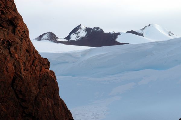
A triple-peaked mountain, about 6 km south of Mt. Hordern in the David Range. Mapped from air photographs taken by the Lars Christensen Expedition (1936-37) and called Tritoppen (The Triple Peak) by Norwegian cartographers.
Named For
Mapped from air photographs taken by the Lars Christensen Expedition (1936-37) and called Tritoppen (The Triple Peak) by Norwegian cartographers.
Location
Latitude:
67° 59' 07.4" S
-67.98539°
Accurate to 30m
Longitude:
62° 28' 53.0" E
62.48139°
Accurate to 30m
Altitude:
1307.4 m
Accurate to 20m
Images
©Wade Fairley 2005
- Catalogue id
- IA16593
- Caption
- Mount Tritoppen
- Photographer
- Fairley, Wade
Map
Source
Location Method:
Topographic data
Source Name:
Framnes Mountains 1:25000 Topographic GIS Dataset
Source Identifier:
fram25k
Source Institution:
Australian Antarctic Division
Source Publisher:
Australian Antarctic Division
Remote sensing:
Not Applicable
Comments
None
Approval status
Date approved:
18-Feb-1958
Related information