Mount Rubin
Rubin, Mount (The name as it would appear in a gazetteer)
Mount Rubin (The name as it would appear on a map)
If this information is incorrect, please e-mail mapping@aad.gov.au
Place ID: 12450
Name ID: 1612
Feature type:
Mountain
Origin
This name originates from Australia.
It is part of the
Australian Antarctic Gazetteer and the SCAR Composite Gazetteer of Antarctica.
Names that other countries have for this feature:
Narrative
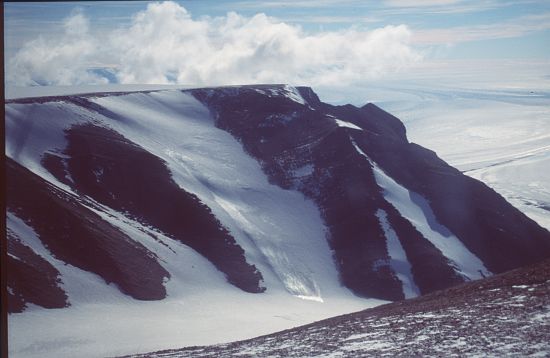
A large, gently domed mountain, with a long tail of moraine, north-west of Patrick Point and south-west of Mount Stinear in the southern Prince Charles Mountains. Photographed by ANARE aircraft in 1956, 1957 and 1958.Named after Morton Rubin, United States observer at the Soviet station, Mirny, in 1958.
Named For
Location
Latitude:
73° 26' 15.4" S
-73.43761°
Accurate to 150m
Longitude:
65° 29' 33.7" E
65.49269°
Accurate to 150m
Altitude:
1560 m
Accurate to 20m
Images
©AAD, Copyright Commonwealth of Australia 1995
- Catalogue id
- 2777D3
- Caption
- Possibly Mt Rubin
- Photographer
- Godbold, Mathew (Matt)
Map
Source
Location Method:
Satellite Image
Source Name:
Landsat Image Mosaic Antarctica (LIMA)
Source Identifier:
E132_CIR_432_1X
Source Institution:
Australian Antarctic Division
Source Publisher:
United States Geological Survey (USGS)
Remote sensing:
Not Applicable
Comments
None
Approval status
Date approved:
22-Jul-1959
Related information