Bandits Bluff
Bandits Bluff (The name as it would appear in a gazetteer)
Bandits Bluff (The name as it would appear on a map)
If this information is incorrect, please e-mail mapping@aad.gov.au
Place ID: 859
Name ID: 203
Feature type:
Bluff
Origin
This name originates from Australia.
It is part of the
Australian Antarctic Gazetteer and the SCAR Composite Gazetteer of Antarctica.
Narrative
A striking black bluff about 40 m above sea level on an unnamed island about 1 km north-west of Barrier Island in the Tryne Islands off the northern part of the Vestfold Hills. Visited by an ANARE field party which established a field hut at the foot of the bluff in July 1983.
Named For
The people involved in the hut construction were referred to at Davis as "The Bandits"
Location
Latitude:
68° 25' 18.1" S
-68.42170°
Accurate to 30m
Longitude:
78° 23' 04.9" E
78.38470°
Accurate to 30m
Altitude:
31.5 m
Accurate to 5m
Images
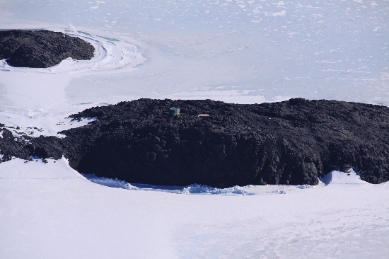
©Belinda Reynolds 2009
- Catalogue id
- IA21843
- Caption
- Bandits Bluff, Vestfold Hills. Taken from helicopter at height of 1000 feet. Looking Northeast.
- Photographer
- Reynolds, Belinda
Map
Source
Location Method:
Topographic data
Source Name:
Vestfold Hills Topographic GIS Dataset
Source Identifier:
vest_hills_gis
Source Institution:
Australian Antarctic Division
Source Publisher:
Australian Antarctic Division
Remote sensing:
Not Applicable
Comments
Metadata for coordinates and origin of topographic data.
Approval status
Date approved:
15-Mar-1984
Related information