Long Peninsula
Long Peninsula (The name as it would appear in a gazetteer)
Long Peninsula (The name as it would appear on a map)
If this information is incorrect, please e-mail mapping@aad.gov.au
Place ID: 8105
Name ID: 2086
Feature type:
Peninsula
Origin
This name originates from Australia.
It is part of the
Australian Antarctic Gazetteer and the SCAR Composite Gazetteer of Antarctica.
Names that other countries have for this feature:
Narrative
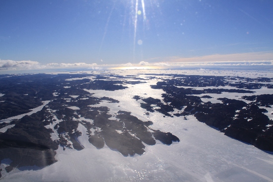
A narrow, sinuous, rocky peninsula about 19 km long, in the northern section of the Vestfold Hills. Mapped from air photographs taken by the Lars Christensen Expedition (1936-37) and called Langneset (The Long Point) by Norwegian cartographers.
Named For
Location
Latitude:
68° 28' 20.0" S
-68.47222°
Accurate to 30m
Longitude:
78° 14' 40.0" E
78.24444°
Accurate to 30m
Altitude:
91 m
Accurate to 5m
Images
©Nathan Saunders 2009
- Catalogue id
- IA21938
- Caption
- Long Peninsula, Vestfold Hills. Taken from helicopter at height of 2000 feet. Looking North.
- Photographer
- Saunders, Nathan
Map
Source
Location Method:
Topographic data
Source Name:
Vestfold Hills Topographic GIS Dataset
Source Identifier:
vest_hills_gis
Source Institution:
Australian Antarctic Division
Source Publisher:
Australian Antarctic Division
Remote sensing:
Not Applicable
Comments
Metadata for coordinates and origin of topographic data.
Approval status
Date approved:
4-Sep-1956
Related information