Zappert Point
Zappert Point (The name as it would appear in a gazetteer)
Zappert Point (The name as it would appear on a map)
If this information is incorrect, please e-mail mapping@aad.gov.au
Place ID: 16442
Name ID: 2193
Feature type:
Point
Origin
This name originates from Australia.
It is part of the
Australian Antarctic Gazetteer and the SCAR Composite Gazetteer of Antarctica.
Narrative
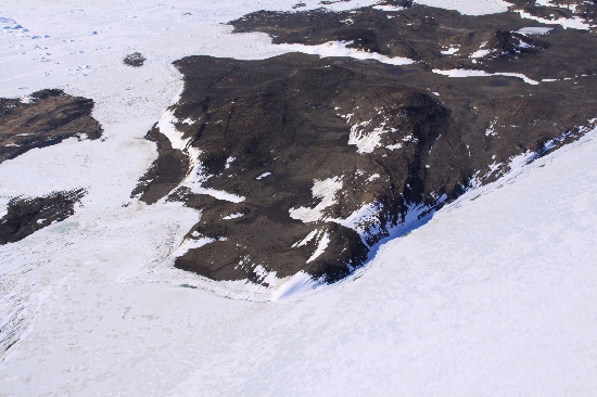
A point on the south-west part of Long Peninsula, adjacent to the large adélie penguin colony. It was the site of a boat landing and food depot in 1972.
Named For
Named after M.D. Zappert, radio supervisor at Davis in 1970.
Location
Latitude:
68° 30' 16.2" S
-68.50450°
Accurate to 30m
Longitude:
78° 05' 00.0" E
78.08331°
Accurate to 30m
Altitude:
41 m
Accurate to 5m
Images
©Rick Oates 2009
- Catalogue id
- IA22044
- Caption
- Zappert Point, Vestfold Hills. Taken from helicopter at height of 2200 feet. Looking East.
- Photographer
- Oates, Rick
Map
Source
Location Method:
Topographic data
Source Name:
Vestfold Hills Topographic GIS Dataset
Source Identifier:
Metadata (
vest_hills_gis - Vestfold Hills 1:25000 Topographic GIS Dataset )
Source Institution:
Australian Antarctic Division
Source Publisher:
Australian Antarctic Division
Remote sensing:
Not Applicable
Comments
Metadata for coordinates and origin of topographic data.
Approval status
Date approved:
27-Nov-1973
Related information