Casey Range
Casey Range (The name as it would appear in a gazetteer)
Casey Range (The name as it would appear on a map)
If this information is incorrect, please e-mail mapping@aad.gov.au
Place ID: 2381
Name ID: 2233
Feature type:
Range
Origin
This name originates from Australia.
It is part of the
Australian Antarctic Gazetteer and the SCAR Composite Gazetteer of Antarctica.
Names that other countries have for this feature:
Narrative
A jagged, razor-backed ridge and several nunataks in line extending north-south, parallel to the David and Masson Ranges in Mac.Robertson Land. Discovered on 5 January, 1930, by BANZARE (1929-31) under Sir Douglas Mawson. The Rt., Hon R G Casey (later Lord Casey) who was at the time the Australian political liaison officer in London, and closely associated with BANZARE.
Named For
Location
Latitude:
67° 44' 28.2" S
-67.74117°
Accurate to 30m
Longitude:
62° 12' 56.3" E
62.21564°
Accurate to 30m
Altitude:
957 m
Accurate to 20m
Images
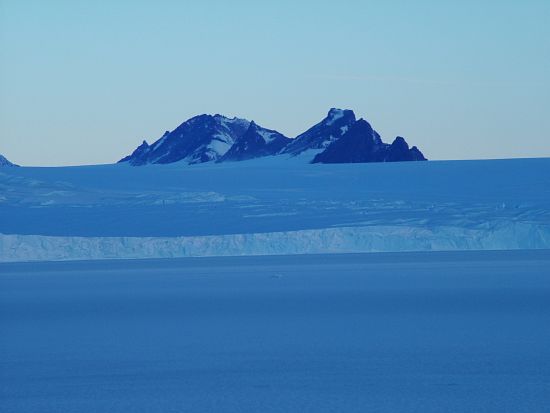
©Doug McVeigh 2004
- Catalogue id
- IA4366
- Caption
- Casey Range viewed from the fast ice
- Photographer
- McVeigh, Doug
Map
Source
Location Method:
Topographic data
Source Name:
Framnes Mountains 1:25000 Topographic GIS Dataset
Source Identifier:
fram25k
Source Institution:
Australian Antarctic Division
Source Publisher:
Australian Antarctic Division
Remote sensing:
Not Applicable
Comments
Location - highest point on range.
Approval status
Related information