Ellis Rapids
Ellis Rapids (The name as it would appear in a gazetteer)
Ellis Rapids (The name as it would appear on a map)
If this information is incorrect, please e-mail mapping@aad.gov.au
Place ID: 4200
Name ID: 2254
Feature type:
Watercourse
Origin
This name originates from Australia.
It is part of the
Australian Antarctic Gazetteer and the SCAR Composite Gazetteer of Antarctica.
Narrative
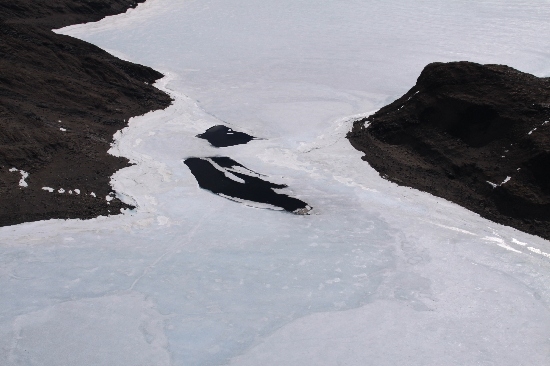
A meltwater stream flowing rapidly in summer from the lakes into the head of Ellis Fjord, Vestfold Hills. The rapids were crossed by an ANARE party who erected a flying fox across it in January 1972.
Named For
Named from Ellis Fjord by the field party.
Location
Latitude:
68° 35' 58.2" S
-68.59950°
Accurate to 30m
Longitude:
78° 13' 48.4" E
78.23011°
Accurate to 30m
Altitude:
3 m
Accurate to 5m
Images
©Belinda Reynolds 2009
- Catalogue id
- IA21888
- Caption
- Ellis Rapids, Vestfold Hills. Taken from helicopter at height of 1000 feet. Looking West.
- Photographer
- Reynolds, Belinda
Map
Source
Location Method:
Topographic data
Source Name:
Vestfold Hills Topographic GIS Dataset
Source Identifier:
vest_hills_gis
Source Institution:
Australian Antarctic Division
Source Publisher:
Australian Antarctic Division
Remote sensing:
Not Applicable
Comments
Metadata for coordinates and origin of topographic data.
Approval status
Related information