Talg River
Talg River (The name as it would appear in a gazetteer)
Talg River (The name as it would appear on a map)
If this information is incorrect, please e-mail mapping@aad.gov.au
Place ID: 14401
Name ID: 2366
Feature type:
Watercourse
Origin
This name originates from Australia.
It is part of the
Australian Antarctic Gazetteer and the SCAR Composite Gazetteer of Antarctica.
Narrative
A major river in the Vestfold Hills draining from the Sørsdal Glacier into Crooked Lake. The flow in the melt season is torrential and occurs across ice and over an ice waterfall. The flow occurs in a well-defined meandering channel cut in the ice. Talg is Arabic for "ice".
Named For
Location
Latitude:
68° 37' 47.0" S
-68.62972°
Accurate to 20m
Longitude:
78° 22' 53.9" E
78.38164°
Accurate to 20m
Altitude:
30 m
Accurate to 5m
Images
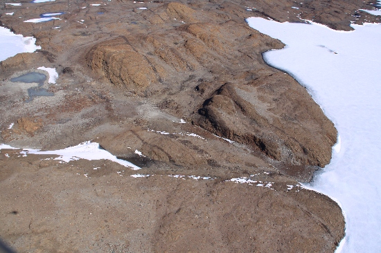
©Richard 'Tubby' Seton 2009
- Catalogue id
- IA22006
- Caption
- Talg River, Vestfold Hills. Taken from helicopter at height of 1200 feet. Looking South.
- Photographer
- Seton, Richard
Map
Source
Location Method:
Topographic data
Source Name:
Vestfold Hills Topographic GIS Dataset
Source Identifier:
vest_hills_gis
Source Institution:
Australian Antarctic Division
Source Publisher:
Australian Antarctic Division
Remote sensing:
Not Applicable
Comments
Metadata for coordinates and origin of topographic data.
Approval status
Date approved:
15-Mar-1984
Related information