Heidemann Valley
Heidemann Valley (The name as it would appear in a gazetteer)
Heidemann Valley (The name as it would appear on a map)
If this information is incorrect, please e-mail mapping@aad.gov.au
Place ID: 6186
Name ID: 2538
Feature type:
Valley
Origin
This name originates from Australia.
It is part of the
Australian Antarctic Gazetteer and the SCAR Composite Gazetteer of Antarctica.
Narrative
A linear valley in the Vestfold Hills about 800 m wide and 3 km long running north-east from Heidemann Bay to the south-east corner of Lake Dingle.
Named For
Location
Latitude:
68° 34' 26.8" S
-68.57411°
Accurate to 30m
Longitude:
78° 01' 16.7" E
78.02131°
Accurate to 30m
Altitude:
5 m
Accurate to 5m
Images
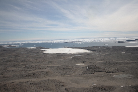
©Nathan Saunders 2009
- Catalogue id
- IA21901
- Caption
- Heidemann Valley, Vestfold Hills. Taken from helicopter at height of 1000 feet. Looking West.
- Photographer
- Saunders, Nathan
Map
Source
Location Method:
Topographic data
Source Name:
Vestfold Hills Topographic GIS Dataset
Source Identifier:
vest_hills_gis
Source Institution:
Australian Antarctic Division
Source Publisher:
Australian Antarctic Division
Remote sensing:
Not Applicable
Comments
Metadata for coordinates and origin of topographic data.
Approval status
Date approved:
26-Jul-1983
Related information