Caloplaca Cliff
Caloplaca Cliff (The name as it would appear in a gazetteer)
Caloplaca Cliff (The name as it would appear on a map)
If this information is incorrect, please e-mail mapping@aad.gov.au
Place ID: 2214
Name ID: 347
Feature type:
Cliff
Origin
This name originates from Australia.
It is part of the
Australian Antarctic Gazetteer and the SCAR Composite Gazetteer of Antarctica.
Narrative
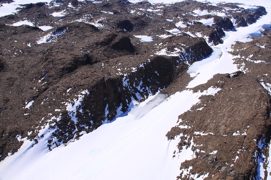
A gneiss cliff in the Vestfold Hills facing south to south-east with prominent patches of orange lichen Caloplaca visible from 1-2 km to the south. The cliff is about 2 km long and 30 m high.
Named For
Named after the patches of Caloplaca lichen growing on the cliff.
Location
Latitude:
68° 34' 02.6" S
-68.56740°
Accurate to 30m
Longitude:
78° 27' 00.4" E
78.45010°
Accurate to 30m
Altitude:
116.5 m
Accurate to 5m
Images
©Richard 'Tubby' Seton 2009
- Catalogue id
- IA21861
- Caption
- Caloplaca Cliff, Vestfold Hills. Taken from helicopter at height of 1000 feet. Looking Northeast.
- Photographer
- Seton, Richard
Map
Source
Location Method:
Topographic data
Source Name:
Vestfold Hills Topographic GIS Dataset
Source Identifier:
vest_hills_gis
Source Institution:
Australian Antarctic Division
Source Publisher:
Australian Antarctic Division
Remote sensing:
Not Applicable
Comments
Metadata for coordinates and origin of topographic data.
Approval status
Date approved:
26-Jul-1983
Related information