Chelnok Falls
Chelnok Falls (The name as it would appear in a gazetteer)
Chelnok Falls (The name as it would appear on a map)
If this information is incorrect, please e-mail mapping@aad.gov.au
Place ID: 2584
Name ID: 418
Feature type:
Fall
Origin
This name originates from Australia.
It is part of the
Australian Antarctic Gazetteer and the SCAR Composite Gazetteer of Antarctica.
Narrative
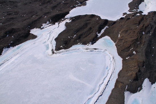
These falls in the Vestfold Hills are 5 m high and are located where the creek from Chelnok Lake runs over a dolerite dyke.
Named For
Location
Latitude:
68° 39' 04.7" S
-68.65131°
Accurate to 50m
Longitude:
78° 17' 10.0" E
78.28611°
Accurate to 50m
Altitude:
40 m
Accurate to 5m
Images
©Richard 'Tubby' Seton 2009
- Catalogue id
- IA21868
- Caption
- Chelnok Falls, Vestfold Hills. Taken from helicopter at height of 1000 feet. Looking South.
- Photographer
- Seton, Richard
Map
Source
Location Method:
Topographic data
Source Name:
Vestfold Hills Topographic GIS Dataset
Source Identifier:
vest_hills_gis
Source Institution:
Australian Antarctic Division
Source Publisher:
Australian Antarctic Division
Remote sensing:
Aerail photography:
ANTC1045, Run7, Frames 136 and 137 (11/Feb/1997)
Comments
Metadata for coordinates and origin of topographic data.
Approval status
Date approved:
26-Jul-1983
Related information