Tryne Fjord
Tryne Fjord (The name as it would appear in a gazetteer)
Tryne Fjord (The name as it would appear on a map)
If this information is incorrect, please e-mail mapping@aad.gov.au
Place ID: 15012
Name ID: 427
Feature type:
Fjord
Origin
This name originates from Australia.
It is part of the
Australian Antarctic Gazetteer and the SCAR Composite Gazetteer of Antarctica.
Names that other countries have for this feature:
Narrative
An irregular-shaped inlet about 7km long, on the northern side of Long Peninsula in the northern part of the Vestfold Hills. It extends from Tryne Crossing to the point on Long Peninsula south of Barrier Island. The latter demarcating Tryne Sound from Tryne Fjord.
Named For
Mapped and named by Norwegian cartographers from air photographs taken by the Lars Christensen Expedition (1936-37).
Location
Latitude:
68° 27' 29.9" S
-68.45831°
Accurate to 25m
Longitude:
78° 22' 23.5" E
78.37319°
Accurate to 25m
Altitude:
0 m
Accurate to 5m
Images
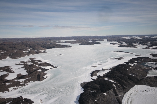
©Nathan Saunders 2009
- Catalogue id
- IA22026
- Caption
- Tryne Fjord, Vestfold Hills. Taken from helicopter at height of 1500 feet. Looking South.
- Photographer
- Saunders, Nathan
Map
Source
Location Method:
Topographic data
Source Name:
Vestfold Hills Topographic GIS Dataset
Source Identifier:
vest_hills_gis
Source Institution:
Australian Antarctic Division
Source Publisher:
Australian Antarctic Division
Remote sensing:
Not Applicable
Comments
None
Approval status
Date approved:
4-Sep-1956
Related information