Onley Hill
Onley Hill (The name as it would appear in a gazetteer)
Onley Hill (The name as it would appear on a map)
If this information is incorrect, please e-mail mapping@aad.gov.au
Place ID: 10641
Name ID: 685
Feature type:
Hill
Origin
This name originates from Australia.
It is part of the
Australian Antarctic Gazetteer and the SCAR Composite Gazetteer of Antarctica.
Names that other countries have for this feature:
Narrative
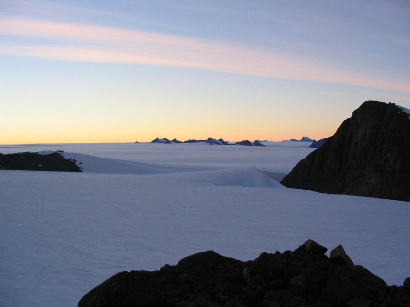
A bare rock eminence rising from surrounding high drifts about 2 km south of Mount Henderson, Mac.Robertson Land. Visited by ANARE parties since 1954. Named after L. Onley, weather observer at Mawson in 1959.
Named For
L. Onley, weather observer at Mawson in 1959
Location
Latitude:
67° 42' 52.2" S
-67.71450°
Accurate to 30m
Longitude:
63° 02' 12.2" E
63.03672°
Accurate to 30m
Altitude:
785 m
Accurate to 20m
Images
©Mel Fitzpatrick 2003
- Catalogue id
- IA16474
- Caption
- Onley Hill (at right) looking southwest from the ridge above Henderson Hut. In the distance is the Central Masson Range.
- Photographer
- Fitzpatrick, Mel
Map
Source
Location Method:
Topographic data
Source Name:
Framnes Mountains 1:25000 Topographic GIS Dataset
Source Identifier:
fram25k
Source Institution:
Australian Antarctic Division
Source Publisher:
Australian Antarctic Division
Remote sensing:
Not Applicable
Comments
None
Approval status
Date approved:
11-Oct-1960
Related information