Keuken Island
Keuken Island (The name as it would appear in a gazetteer)
Keuken Island (The name as it would appear on a map)
If this information is incorrect, please e-mail mapping@aad.gov.au
Place ID: 7486
Name ID: 797
Feature type:
Island
Origin
This name originates from Australia.
It is part of the
Australian Antarctic Gazetteer and the SCAR Composite Gazetteer of Antarctica.
Names that other countries have for this feature:
Narrative
A small island 1 km west of Gardner Island, off the Vestfold Hills. Mapped by Norwegian cartographers from air photographs taken by the Lars Christensen Expedition (1936-37).
Named For
Named after J. Keuken, weather observer (radio) at Davis in 1959.
Location
Latitude:
68° 34' 27.1" S
-68.57419°
Accurate to 30m
Longitude:
77° 49' 56.3" E
77.83231°
Accurate to 30m
Altitude:
16 m
Accurate to 5m
Images
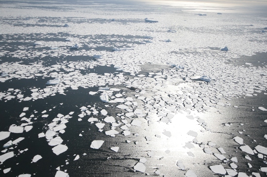
©Nathan Saunders 2009
- Catalogue id
- IA21909
- Caption
- Keuken Island, Vestfold Hills. Taken from helicopter at height of 2500 feet. Looking West.
- Photographer
- Saunders, Nathan
Map
Source
Location Method:
Topographic data
Source Name:
Vestfold Hills Topographic GIS Dataset
Source Identifier:
vest_hills_gis
Source Institution:
Australian Antarctic Division
Source Publisher:
Australian Antarctic Division
Remote sensing:
Not Applicable
Comments
Metadata for coordinates and origin of topographic data.
Approval status
Date approved:
4-Jul-1961
Related information