Chappel Island
Chappel Island (The name as it would appear in a gazetteer)
Chappel Island (The name as it would appear on a map)
If this information is incorrect, please e-mail mapping@aad.gov.au
Place ID: 2527
Name ID: 831
Feature type:
Island
Origin
This name originates from Australia.
It is part of the
Australian Antarctic Gazetteer and the SCAR Composite Gazetteer of Antarctica.
Names that other countries have for this feature:
Narrative
The largest of the Donovan Islands, about 11 km north-west of Casey station. The island has a number of large Adelie penguin rookeries. Photographed by USN Operation Highjump (1946-47). An expedition led by Phillip Law attempted an approach in Kista Dan on 20 January, 1956, but a landing could not be made because of the shallow water. However, low level photographs were taken from the expedition's aircraft. Named Chappel Island by USACAN.
Named For
Location
Latitude:
66° 10' 38.3" S
-66.17731°
Accurate to 30m
Longitude:
110° 25' 04.1" E
110.41781°
Accurate to 30m
Altitude:
49.6 m
Accurate to 2m
Images
©AAD, Copyright Commonwealth of Australia 1973
- Catalogue id
- 1360B6
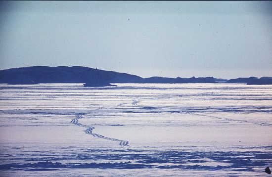
- Caption
- Foot tracks on sea ice. Chappel Island in the distance.
- Photographer
- McInnes, Gordon E
Map
Source
Location Method:
Topographic data
Source Name:
Windmill Islands 1:50000 GIS Dataset
Source Identifier:
Wind50K
Source Institution:
Australian Antarctic Division
Source Publisher:
Australian Antarctic Division
Remote sensing:
Not Applicable
Comments
None
Approval status
Date approved:
11-Aug-1958
Related information