Mule Island
Mule Island (The name as it would appear in a gazetteer)
Mule Island (The name as it would appear on a map)
If this information is incorrect, please e-mail mapping@aad.gov.au
Place ID: 9945
Name ID: 885
Feature type:
Island
Origin
This name originates from Australia.
It is part of the
Australian Antarctic Gazetteer and the SCAR Composite Gazetteer of Antarctica.
Names that other countries have for this feature:
Narrative
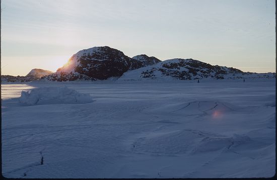
A small island about 1 km long and up to 0.5 km wide, off the southern part of the Vestfold Hills.
Named For
Mapped from air photographs taken by the Lars Christensen Expedition (1936-37) and called mulxy (Snout Island) by Norwegian cartographers.
Location
Latitude:
68° 38' 47.4" S
-68.64650°
Accurate to 30m
Longitude:
77° 49' 38.3" E
77.82731°
Accurate to 30m
Altitude:
33.5 m
Accurate to 5m
Images
©AAD, Copyright Commonwealth of Australia 1973
- Catalogue id
- 885B1
- Photographer
- Rounsevell, David E (Dave)
Map
Source
Location Method:
Topographic data
Source Name:
Vestfold Hills Topographic GIS Dataset
Source Identifier:
vest_hills_gis
Source Institution:
Australian Antarctic Division
Source Publisher:
Australian Antarctic Division
Remote sensing:
Not Applicable
Comments
Metadata for coordinates and origin of topographic data.
Approval status
Related information