Robinson Group
Robinson Group (The name as it would appear in a gazetteer)
Robinson Group (The name as it would appear on a map)
If this information is incorrect, please e-mail mapping@aad.gov.au
Place ID: 12243
Name ID: 899
Feature type:
Island
Origin
This name originates from Australia.
It is part of the
Australian Antarctic Gazetteer and the SCAR Composite Gazetteer of Antarctica.
Names that other countries have for this feature:
Narrative
A group of islands about 19 km west of Cape Daly in Mac.Robertson Land. Discovered on about 13 February 1931 by BANZARE (1929-31) under Sir Douglas Mawson, who named it after Mr W.S. Robinson of Melbourne, a patron of the expedition.
Named For
Mr W.S. Robinson
Location
Latitude:
67° 26' 54.0" S
-67.44833°
Unknown precision
Longitude:
63° 26' 20.0" E
63.43889°
Unknown precision
Altitude:
Not recorded
Unknown precision
Images
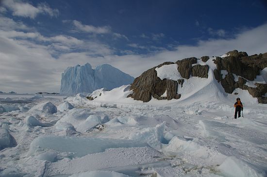
©Matthew Low 2005
- Catalogue id
- IA8318
- Caption
- Unmapped island in the Robinson Group with grounded iceberg in background.
- Photographer
- Low Matthew (Matt)
Map
Source
Source Institution:
Unknown
Source Publisher:
Unknown
Remote sensing:
Not Applicable
Comments
None
Approval status
Date approved:
28-Nov-1955
Related information