Magnetic Island
Magnetic Island (The name as it would appear in a gazetteer)
Magnetic Island (The name as it would appear on a map)
If this information is incorrect, please e-mail mapping@aad.gov.au
Place ID: 8851
Name ID: 930
Feature type:
Island
Origin
This name originates from Australia.
It is part of the
Australian Antarctic Gazetteer and the SCAR Composite Gazetteer of Antarctica.
Names that other countries have for this feature:
Narrative
A small island situated in the north-east part of Prydz Bay about 5 km from the coast of Vestfold Hills and about 5 km north-west of Davis. Charted from air photographs taken by the Lars Christensen Expedition (1936-37). Visited by an ANARE party led by Phillip Law on 3 March, 1954. Named because magnetic observations taken by J. Brooks showed the declination to be anomalous.
Named For
Location
Latitude:
68° 32' 34.8" S
-68.54300°
Accurate to 30m
Longitude:
77° 54' 31.7" E
77.90881°
Accurate to 30m
Altitude:
58.5 m
Accurate to 5m
Images
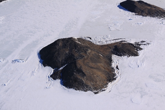
©Nathan Saunders 2009
- Catalogue id
- IA21943
- Caption
- Magnetic Island, Vestfold Hills. Taken from helicopter at height of 2500 feet. Looking North.
- Photographer
- Saunders, Nathan
Map
Source
Location Method:
Topographic data
Source Name:
Vestfold Hills Topographic GIS Dataset
Source Identifier:
vest_hills_gis
Source Institution:
Australian Antarctic Division
Source Publisher:
Australian Antarctic Division
Remote sensing:
Not Applicable
Comments
Metadata for coordinates and origin of topographic data.
Approval status
Related information